Our pictures from cities and other locations
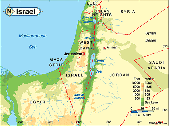
All marked (numbered) trails are included in 20 topographic maps covering Israel area.
In the following pages are our pictures along those trails.
In the following pages are our pictures along those trails.
KKL-JNF is the abbreviation for Keren Kayament LeIsrael - Jewish National Fund.
One of their goals is to plant forests, create parks and recreation areas and transform rocky hills and wasteland into blossoming, green country, to restore life to Israel's rivers and make them visitor hubs lush with flora and fauna.
Here are our pictures from visits in their forests.
One of their goals is to plant forests, create parks and recreation areas and transform rocky hills and wasteland into blossoming, green country, to restore life to Israel's rivers and make them visitor hubs lush with flora and fauna.
Here are our pictures from visits in their forests.
Pictures from our trips in nature reservation and parks belonging to Israel Nature and National Parks Protection Authority.
Our pictures that were taken during traveling on marked (numbered) roads.

updated: 22.06.07 12:10
© Kalmanovitz Bros. 2002